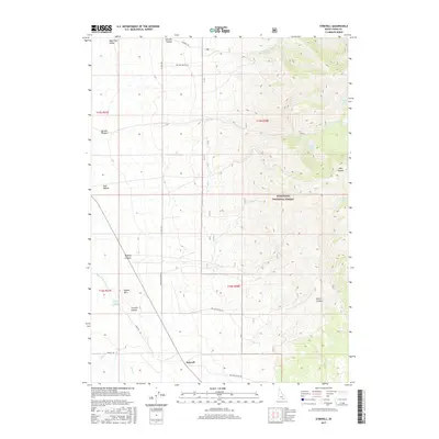
2017 Map of Strevell
USGS Topo · Published 2017About this map
The settlement of Strevell sits at a high-elevation crossroads in Cassia County, where the topography shifts from the open reaches of the Raft River Valley into the steep drainages of the Sawtooth National Forest. This 2017 survey details a landscape where water is the primary driver of name and placement, from high-country sources like South Fork Kelsaw Spring and Rice Canyon Spring to the Sixmile Reservoir tucked into the northern ridges. The map highlights the intersection of forest service access and local routes, tracing Kelsaw Canyon Rd and Jones Rd through a series of dramatic landforms including Round Mtn and Strevell Canyon. This is a portrait of a working high-desert environment, where canyon systems like Moberg Canyon and Green Canyon define the ranching and resource management of the Idaho-Utah borderlands.
Find a feature on this map
31 named features on this map. Tap any name to fly to it.
Don’t see what you’re looking for? This feature index may not catch every label — zoom into the map to look around manually.
Map Details
Editions of this 2017 Strevell Map
This is the sole edition of this map. No revisions or reprints were ever made.
Other maps of this area

1954 · Pocatello
USGS Topo · 1:250,000

1954 · Brigham City
USGS Topo · 1:250,000

1958 · Pocatello
USGS Topo · 1:250,000

1958 · Brigham City
USGS Topo · 1:250,000

1959 · Strevell
USGS Topo · 1:62,500

1959 · Kelton Pass
USGS Topo · 1:62,500

1959 · Park Valley
USGS Topo · 1:62,500

1962 · Brigham City
USGS Topo · 1:250,000

1968 · Naf
USGS Topo · 1:24,000

1968 · Bridge
USGS Topo · 1:24,000