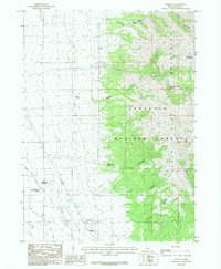
1985 Map of Strevell
USGS Topo · Published 1985About this map
The settlement of Strevell sits at a high-elevation crossroads in Cassia County, where the southern reaches of the Black Mountains meet the high desert floor. The landscape is defined by the deep incisions of Sixmile Canyon, Kelsaw Canyon, and Moberg Canyon which cut through the Sawtooth Pine National Forest. Traces of earlier transportation and infrastructure are evident, notably the Old Railroad Grade and the Naf Trail, which connect the remote outposts of the region. Water remains a critical resource in this arid environment, marked by the presence of Sixmile Reservoir and several named water sources such as Hidden Rock Spring and Round Mountain Spring. Aviation history is signaled by the Airway Beacon and a second Air Beacon located near the townsite, highlighting the area's role in early navigation corridors through the Idaho interior.
Find a feature on this map
25 named features on this map. Tap any name to fly to it.
Don’t see what you’re looking for? This feature index may not catch every label — zoom into the map to look around manually.
Map Details
Editions of this 1985 Strevell Map
This is the sole edition of this map. No revisions or reprints were ever made.
Other maps of this area

1954 · Pocatello
USGS Topo · 1:250,000

1954 · Brigham City
USGS Topo · 1:250,000

1958 · Pocatello
USGS Topo · 1:250,000

1958 · Brigham City
USGS Topo · 1:250,000

1959 · Strevell
USGS Topo · 1:62,500

1959 · Kelton Pass
USGS Topo · 1:62,500

1959 · Park Valley
USGS Topo · 1:62,500

1962 · Brigham City
USGS Topo · 1:250,000

1968 · Naf
USGS Topo · 1:24,000

1968 · Bridge
USGS Topo · 1:24,000