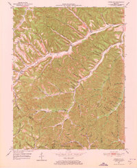
1951 Map of Stricklett
USGS Topo · Published 1973About this map
Kinniconick Creek carves a deep, winding valley through this part of Lewis County, serving as the primary corridor for settlements like Stricklett and Petersville. The landscape in the early 1950s is defined by a dense network of hollows and ridges, where isolated community life centered on rural institutions such as the Kinniconick Sch and Thackers Chapel. Numerous family-named landmarks like McEldowney Cem and Big Johnson Hollow indicate a long-established residential pattern tied to the terrain.
Find a feature on this map
81 named features on this map. Tap any name to fly to it.
Don’t see what you’re looking for? This feature index may not catch every label — zoom into the map to look around manually.
Map Details
Editions of this 1951 Stricklett Map
4 editions found

Other maps of this area

1919 · Vanceburg
USGS Topo · 1:62,500

1929 · Springdale
USGS Topo · 1:48,000

1935 · Springdale
USGS Topo · 1:62,500

1949 · Vanceburg
USGS Topo · 1:62,500

1949 · Vanceburg
USGS Topo · 1:24,000

1949 · Charters
USGS Topo · 1:24,000

1950 · Charters
USGS Topo · 1:24,000

1950 · Head Of Grassy
USGS Topo · 1:24,000
1951 · Vanceburg
USGS Topo · 1:24,000

1951 · Soldier
USGS Topo · 1:24,000