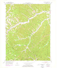
1951 Map of Stricklett
USGS Topo · Published 1978About this map
Kinniconick Creek winds through a landscape of deep hollows and narrow ridges in this mid-century look at Lewis County. Small crossroads and hamlets like Stricklett and Petersville serve as anchors for a rural community connected by Kentucky routes 344 and 377. The map reveals a dense network of local schools and churches, such as Kinniconick Sch and Oak Ridge Ch, indicating a time when schooling and social life were strictly decentralized along the many branches of the creek system.
Find a feature on this map
87 named features on this map. Tap any name to fly to it.
Don’t see what you’re looking for? This feature index may not catch every label — zoom into the map to look around manually.
Map Details
Editions of this 1951 Stricklett Map
4 editions found

Other maps of this area

1919 · Vanceburg
USGS Topo · 1:62,500

1929 · Springdale
USGS Topo · 1:48,000

1935 · Springdale
USGS Topo · 1:62,500

1949 · Vanceburg
USGS Topo · 1:62,500

1949 · Vanceburg
USGS Topo · 1:24,000

1949 · Charters
USGS Topo · 1:24,000

1950 · Charters
USGS Topo · 1:24,000

1950 · Head Of Grassy
USGS Topo · 1:24,000
1951 · Vanceburg
USGS Topo · 1:24,000

1951 · Soldier
USGS Topo · 1:24,000