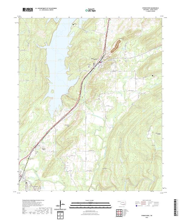
2022 Map of Stringtown
USGS Topo · Published 2022About this map
Atoka Reservoir dominates the western half of this landscape, its fingers reaching into the valley between Black Knob Ridge and the rising uplands to the east. The town of Stringtown serves as a central hub, situated along a primary transit corridor that follows the natural breaks in the terrain like Grants Gap and Sand Gap. This area of Atoka County is marked by several small burial sites that offer clues for local genealogists, including the Confederate Cem and the Boggy Bend Cem near the reservoir’s northern edge. The hydrology of the region is defined by the winding paths of North Boggy Creek and Muddy Boggy Creek, which cut through open spaces like West Windy Prairie and Prairie Hollow. The map reveals a transition from the structured residential blocks of Atoka in the southwest to the more dispersed rural road networks like Greasy Bend Rd and Samata Ford Rd.
Find a feature on this map
54 named features on this map. Tap any name to fly to it.
Don’t see what you’re looking for? This feature index may not catch every label — zoom into the map to look around manually.
Map Details
Editions of this 2022 Stringtown Map
This is the sole edition of this map. No revisions or reprints were ever made.
Other maps of this area

1896 · Coalgate
USGS Topo · 1:125,000

1898 · McAlester
USGS Topo · 1:125,000

1899 · Coalgate
USGS Topo · 1:125,000

1899 · Atoka
USGS Topo · 1:125,000

1900 · Atoka
USGS Topo · 1:125,000

1900 · Coalgate
USGS Topo · 1:125,000

1901 · Antlers
USGS Topo · 1:125,000

1909 · Mc Alester
USGS Topo · 1:125,000

1912 · Antlers
USGS Topo · 1:125,000

1925 · Antlers
USGS Topo · 1:125,000