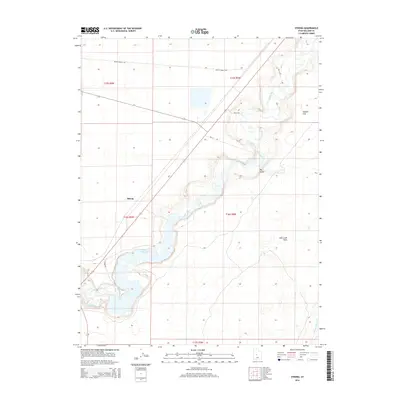
2014 Map of Strong
USGS Topo · Published 2014About this map
The Sevier River carves a winding path through this portion of Millard County, feeding into the substantial D M A D Reservoir which serves as a central hydrological feature for the region. This 2014 survey documents the complex water management infrastructure essential to this arid landscape, including Canal A and the Central Utah Canal. The settlement of Strong is located near the western bank of the river, positioned amidst a network of rural routes such as Baileys Route Rd and several numbered well roads.
Find a feature on this map
18 named features on this map. Tap any name to fly to it.
Don’t see what you’re looking for? This feature index may not catch every label — zoom into the map to look around manually.
Map Details
Editions of this 2014 Strong Map
This is the sole edition of this map. No revisions or reprints were ever made.
Other maps of this area

1885 · Sevier Desert
USGS Topo · 1:250,000

1951 · Oak City
USGS Topo · 1:62,500

1953 · Delta
USGS Topo · 1:250,000

1958 · Delta
USGS Topo · 1:250,000

1962 · Delta
USGS Topo · 1:250,000

1962 · Lynndyl
USGS Topo · 1:62,500

1962 · Delta
USGS Topo · 1:62,500

1971 · Rain Lake
USGS Topo · 1:24,000

1979 · Lynndyl
USGS Topo · 1:100,000
1985 · Harding
USGS Topo · 1:24,000