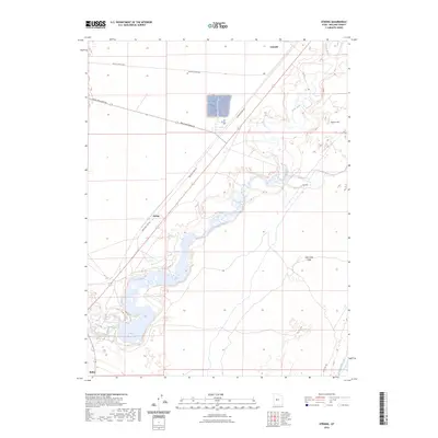
2023 Map of Strong
USGS Topo · Published 2023About this map
The Sevier River carves a winding path through this corner of Millard County, defining a landscape shaped by water management and transit. In the southern reach, the river feeds the DMAD Reservoir, a critical piece of local infrastructure that supports the Central Utah Canal. The settlement of Strong occupies a central position near the riverbank, while the northern edge of the map identifies Lynndyl and the southern edge touches Delta.
Find a feature on this map
13 named features on this map. Tap any name to fly to it.
Don’t see what you’re looking for? This feature index may not catch every label — zoom into the map to look around manually.
Map Details
Editions of this 2023 Strong Map
This is the sole edition of this map. No revisions or reprints were ever made.
Other maps of this area

1885 · Sevier Desert
USGS Topo · 1:250,000

1951 · Oak City
USGS Topo · 1:62,500

1953 · Delta
USGS Topo · 1:250,000

1958 · Delta
USGS Topo · 1:250,000

1962 · Delta
USGS Topo · 1:250,000

1962 · Lynndyl
USGS Topo · 1:62,500

1962 · Delta
USGS Topo · 1:62,500

1971 · Rain Lake
USGS Topo · 1:24,000

1979 · Lynndyl
USGS Topo · 1:100,000
1985 · Harding
USGS Topo · 1:24,000