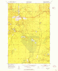
1951 Map of Strongs
USGS Topo · Published 1955About this map
The settlement of Strongs serves as a small hub of activity in the early 1950s, situated at the intersection of the Duluth South Shore and Atlantic railroad and the East Branch Tahquamenon River. The community is marked by its Town Hall, Community Ch, and the Jones Sch, reflecting a classic Upper Peninsula timber or rail-related outpost. North of Strongs Corner, an Old Railroad Grade and Dick Road trace the paths of earlier resource extraction through the Marquette National Forest.
Find a feature on this map
28 named features on this map. Tap any name to fly to it.
Don’t see what you’re looking for? This feature index may not catch every label — zoom into the map to look around manually.
Map Details
Editions of this 1951 Strongs Map
4 editions found
Other maps of this area

1931 · Epoufette NE
USGS Topo · 1:31,680

1941 · Strongs
USGS Topo · 1:63,360

1951 · Strongs
USGS Topo · 1:24,000

1951 · McNearney Lake
USGS Topo · 1:24,000

1951 · Pendills Lake
USGS Topo · 1:24,000

1951 · Piatt Lake
USGS Topo · 1:24,000

1951 · Sullivan Creek
USGS Topo · 1:24,000

1951 · Eckerman
USGS Topo · 1:24,000

1951 · Strongs
USGS Topo · 1:62,500

1951 · Eckerman
USGS Topo · 1:62,500