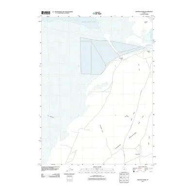
2011 Map of Strongs Knob
USGS Topo · Published 2011About this map
Great Salt Lake dominates the northern reaches of this territory, where the waters of Clyman Bay and Gunnison Bay meet the shoreline near Strongs Knob. This arid landscape is defined by the stark transition from the lake bed to the sharp elevations of the Lakeside Mountains. The terrain here is marked by distinctive geological formations such as Lakeside Butte, Twin Hills, and Gunsight Point, creating a complex topography of ridges and basins.
Find a feature on this map
16 named features on this map. Tap any name to fly to it.
Don’t see what you’re looking for? This feature index may not catch every label — zoom into the map to look around manually.
Map Details
Editions of this 2011 Strongs Knob Map
This is the sole edition of this map. No revisions or reprints were ever made.
Other maps of this area

1954 · Brigham City
USGS Topo · 1:250,000

1958 · Brigham City
USGS Topo · 1:250,000

1962 · Brigham City
USGS Topo · 1:250,000

1968 · Deardens Knoll
USGS Topo · 1:24,000

1969 · Gunnison Island SW
USGS Topo · 1:24,000

1969 · Hogup Ridge South
USGS Topo · 1:24,000

1969 · Strongs Knob
USGS Topo · 1:24,000

1969 · Gunnison Island
USGS Topo · 1:24,000
1969 · Lakeside
USGS Topo · 1:24,000

1969 · Hogup Ridge North
USGS Topo · 1:24,000