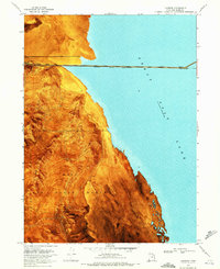
1969 Map of Lakeside
USGS Topo · Published 1972About this map
The Southern Pacific (Lucin Cutoff) bisects the shimmering expanse of the Great Salt Lake on this 1969 orthophotomap, connecting the western shore at Lakeside to the distant point at Tresend. This unique hybrid map uses aerial imagery to reveal the stark contrast between the industrial presence of the railroad and the desolate Mud Flat of the surrounding terrain. To the south, the Hill Air Force Range dominates the land, where the Lakeside Mountains and Death Mountains rise sharply above Sedal Valley.
Find a feature on this map
27 named features on this map. Tap any name to fly to it.
Don’t see what you’re looking for? This feature index may not catch every label — zoom into the map to look around manually.
Map Details
Editions of this 1969 Lakeside Map
2 editions found
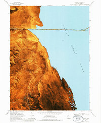
Other maps of this area

1954 · Brigham City
USGS Topo · 1:250,000

1958 · Brigham City
USGS Topo · 1:250,000

1962 · Brigham City
USGS Topo · 1:250,000

1968 · Carrington Island SW
USGS Topo · 1:24,000

1968 · Deardens Knoll
USGS Topo · 1:24,000

1969 · Rozel Point SW
USGS Topo · 1:24,000

1969 · Gunnison Island SW
USGS Topo · 1:24,000

1969 · Carrington Island NW
USGS Topo · 1:24,000

1969 · Strongs Knob
USGS Topo · 1:24,000

1969 · Gunnison Island
USGS Topo · 1:24,000