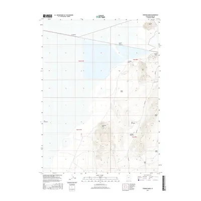
2017 Map of Strongs Knob
USGS Topo · Published 2017About this map
The Southern Pacific Causeway and the Strongknob railroad alignment cut across the northern reaches of this Great Salt Lake environment, illustrating the industrial infrastructure required to traverse this basin. The terrain is defined by the stark elevations of the Lakeside Mountains, which rise sharply from the salt flats to prominent features like Strongs Knob and Lakeside Butte.
Find a feature on this map
20 named features on this map. Tap any name to fly to it.
Don’t see what you’re looking for? This feature index may not catch every label — zoom into the map to look around manually.
Map Details
Editions of this 2017 Strongs Knob Map
This is the sole edition of this map. No revisions or reprints were ever made.
Other maps of this area

1954 · Brigham City
USGS Topo · 1:250,000

1958 · Brigham City
USGS Topo · 1:250,000

1962 · Brigham City
USGS Topo · 1:250,000

1968 · Deardens Knoll
USGS Topo · 1:24,000

1969 · Gunnison Island SW
USGS Topo · 1:24,000

1969 · Hogup Ridge South
USGS Topo · 1:24,000

1969 · Strongs Knob
USGS Topo · 1:24,000

1969 · Gunnison Island
USGS Topo · 1:24,000
1969 · Lakeside
USGS Topo · 1:24,000

1969 · Hogup Ridge North
USGS Topo · 1:24,000