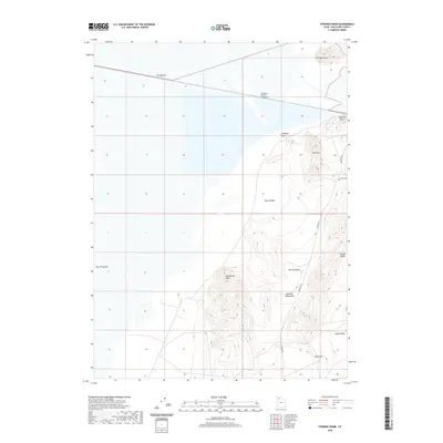
2020 Map of Strongs Knob
USGS Topo · Published 2020About this map
The Southern Pacific Causeway stretches across the northern portion of this map, cutting through the high-salinity environment of Box Elder County. This industrial transport corridor connects the eastern and western shores, passing near the prominent elevation of Strongs Knob. To the south, the topography shifts into the stark elevations of the Lakeside Mountains, where landforms such as Homestead Knoll and The Horseshoe dominate the landscape.
Find a feature on this map
16 named features on this map. Tap any name to fly to it.
Don’t see what you’re looking for? This feature index may not catch every label — zoom into the map to look around manually.
Map Details
Editions of this 2020 Strongs Knob Map
This is the sole edition of this map. No revisions or reprints were ever made.
Other maps of this area

1954 · Brigham City
USGS Topo · 1:250,000

1958 · Brigham City
USGS Topo · 1:250,000

1962 · Brigham City
USGS Topo · 1:250,000

1968 · Deardens Knoll
USGS Topo · 1:24,000

1969 · Gunnison Island SW
USGS Topo · 1:24,000

1969 · Hogup Ridge South
USGS Topo · 1:24,000

1969 · Strongs Knob
USGS Topo · 1:24,000

1969 · Gunnison Island
USGS Topo · 1:24,000
1969 · Lakeside
USGS Topo · 1:24,000

1969 · Hogup Ridge North
USGS Topo · 1:24,000