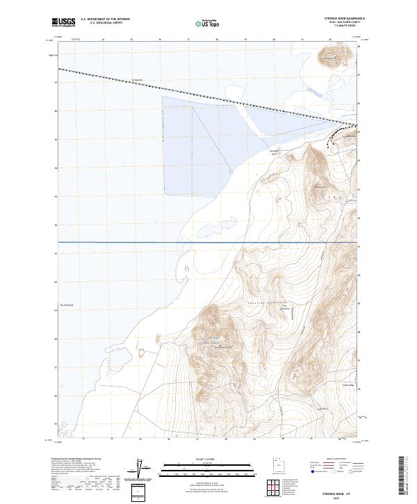
2023 Map of Strongs Knob
USGS Topo · Published 2023About this map
Utah Test and Training Range occupies the central portion of this arid landscape in Box Elder County, where the desert flats meet the rising slopes of the Lakeside Mountains. This modern topographic survey illustrates a region defined by stark geological formations, including Strongs Knob and Lakeside Butte near the northern shorelines, and the distinctive Gunsight Point. The map provides a contemporary view of these remote landforms, tracking the high ground of Death Ridge and the descent into Sedal Valley. Access to this restricted area is documented by Lakeside Rd and Scad Ridge Rd, which skirt the edges of the military range. These roads connect localized landmarks like Homestead Knoll and The Horseshoe, offering an essential record of the modern infrastructure and natural topography of the western salt flats region.
Find a feature on this map
16 named features on this map. Tap any name to fly to it.
Don’t see what you’re looking for? This feature index may not catch every label — zoom into the map to look around manually.
Map Details
Editions of this 2023 Strongs Knob Map
This is the sole edition of this map. No revisions or reprints were ever made.
Other maps of this area

1954 · Brigham City
USGS Topo · 1:250,000

1958 · Brigham City
USGS Topo · 1:250,000

1962 · Brigham City
USGS Topo · 1:250,000

1968 · Deardens Knoll
USGS Topo · 1:24,000

1969 · Gunnison Island SW
USGS Topo · 1:24,000

1969 · Hogup Ridge South
USGS Topo · 1:24,000

1969 · Strongs Knob
USGS Topo · 1:24,000

1969 · Gunnison Island
USGS Topo · 1:24,000
1969 · Lakeside
USGS Topo · 1:24,000

1969 · Hogup Ridge North
USGS Topo · 1:24,000