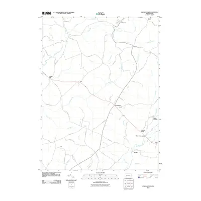
2010 Map of Strongstown
USGS Topo · Published 2010About this map
Strongstown serves as a central junction in this Indiana County landscape, where the road network links the small settlements and rural homesteads of the early 21st century. The map illustrates a region defined by its watercourses, with Yellow Creek and the North Branch Blacklick Creek draining the undulating terrain. Local heritage is visible in the names of community focal points such as the Pine Land Cemetery and Mount Zion Cemetery, while the presence of locations like Ewings Mill, Red Mill, and White Mill Crossing points to a historical reliance on water power and early milling industries. The layout of secondary roads, including Barkley Church Rd and S Factory Hollow Rd, preserves the footprints of older farm-to-market routes and small-scale industrial sites that shaped the development of Brush Valley Township.
Find a feature on this map
68 named features on this map. Tap any name to fly to it.
Don’t see what you’re looking for? This feature index may not catch every label — zoom into the map to look around manually.
Map Details
Editions of this 2010 Strongstown Map
This is the sole edition of this map. No revisions or reprints were ever made.
Other maps of this area

1902 · Indiana
USGS Topo · 1:62,500

1902 · Barnesboro
USGS Topo · 1:62,500

1904 · Barnesboro
USGS Topo · 1:62,500

1904 · Johnstown
USGS Topo · 1:62,500

1907 · Johnstown
USGS Topo · 1:62,500

1920 · New Florence
USGS Topo · 1:62,500

1921 · New Florence
USGS Topo · 1:48,000

1922 · New Florence
USGS Topo · 1:62,500

1943 · Punxsutawney
USGS Topo · 1:125,000

1944 · New Florence
USGS Topo · 1:62,500
Featured Places
- Brush Valley Township, PA
- Pine Township, PA
- Nolo, Pine Township
- Pineton, Pine Township
- Charlies Grove, Blacklick Township