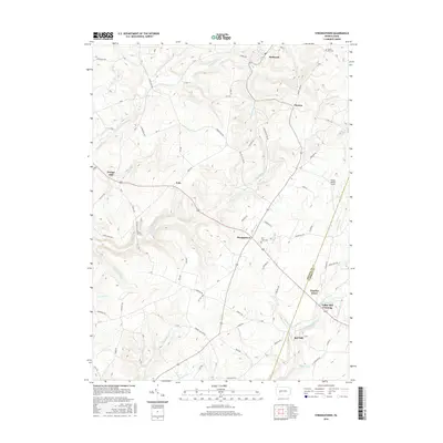
2016 Map of Strongstown
USGS Topo · Published 2016About this map
Heilwood and Strongstown anchor this mapping of the Allegheny Plateau, where the headwaters of numerous runs and creeks carve a complex drainage pattern across the Indiana and Cambria county line. The landscape is defined by its rural industry and community centers, from the northern settlement of Pineton to the southern crossings near White Mill Crossing. Local history is preserved in the location of Mount Zion Cem and Pine Land Cem, alongside small residential clusters like Charlies Grove and Nolo. The map illustrates a dense network of country lanes such as Historical Rd and Old Mill Rd, which reflect the historic transit routes between agricultural holdings and former mill sites like Ewings Mill and Red Mill. Waterways like Yellow Creek and the North Branch Blacklick Creek serve as the primary topographical features shaping the valley's development.
Find a feature on this map
66 named features on this map. Tap any name to fly to it.
Don’t see what you’re looking for? This feature index may not catch every label — zoom into the map to look around manually.
Map Details
Editions of this 2016 Strongstown Map
This is the sole edition of this map. No revisions or reprints were ever made.
Other maps of this area

1902 · Indiana
USGS Topo · 1:62,500

1902 · Barnesboro
USGS Topo · 1:62,500

1904 · Barnesboro
USGS Topo · 1:62,500

1904 · Johnstown
USGS Topo · 1:62,500

1907 · Johnstown
USGS Topo · 1:62,500

1920 · New Florence
USGS Topo · 1:62,500

1921 · New Florence
USGS Topo · 1:48,000

1922 · New Florence
USGS Topo · 1:62,500

1943 · Punxsutawney
USGS Topo · 1:125,000

1944 · New Florence
USGS Topo · 1:62,500
Featured Places
- Brush Valley Township, PA
- Pine Township, PA
- Nolo, Pine Township
- Pineton, Pine Township
- Charlies Grove, Blacklick Township