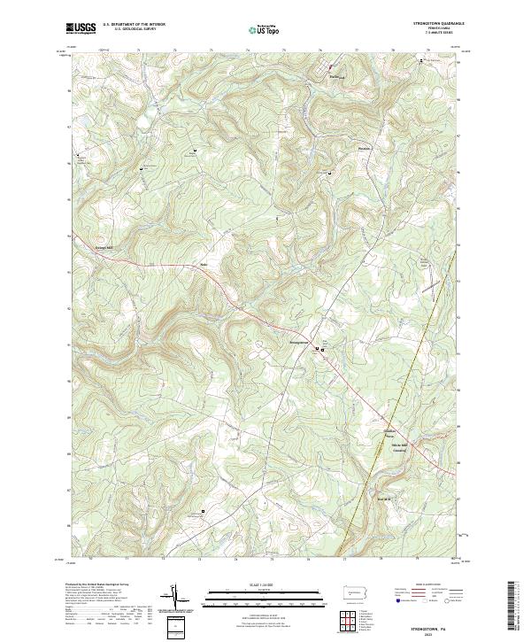
2023 Map of Strongstown
USGS Topo · Published 2023About this map
Strongstown sits at the crossing of major routes on this recent survey of the Indiana and Cambria County border. The landscape is defined by the headwaters of Little Yellow Creek and the North Branch Blacklick Creek, which once powered local industry at sites like Ewings Mill, White Mill Crossing, and Red Mill. These mill names, along with the Ghost Town Trl passing through the southern portion of the quadrangle, point to the region's deep industrial roots and subsequent transition toward recreation.
Find a feature on this map
71 named features on this map. Tap any name to fly to it.
Don’t see what you’re looking for? This feature index may not catch every label — zoom into the map to look around manually.
Map Details
Editions of this 2023 Strongstown Map
This is the sole edition of this map. No revisions or reprints were ever made.
Other maps of this area

1902 · Indiana
USGS Topo · 1:62,500

1902 · Barnesboro
USGS Topo · 1:62,500

1904 · Barnesboro
USGS Topo · 1:62,500

1904 · Johnstown
USGS Topo · 1:62,500

1907 · Johnstown
USGS Topo · 1:62,500

1920 · New Florence
USGS Topo · 1:62,500

1921 · New Florence
USGS Topo · 1:48,000

1922 · New Florence
USGS Topo · 1:62,500

1943 · Punxsutawney
USGS Topo · 1:125,000

1944 · New Florence
USGS Topo · 1:62,500
Featured Places
- Brush Valley Township, PA
- Barr Township, PA
- Blacklick Township, PA
- Cherryhill Township, PA
- Pine Township, PA