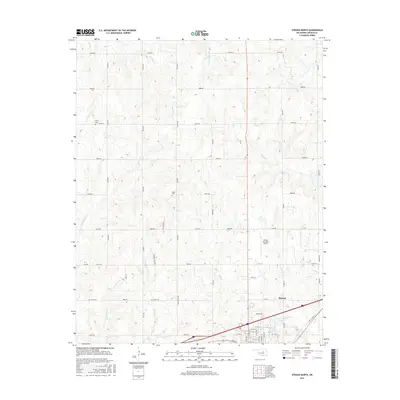
2016 Map of Stroud North
USGS Topo · Published 2016About this map
The Oklahoma countryside north of Stroud is defined by a dense network of sectional roads and small tributaries of the Deep Fork river system. Creeks such as Turkey Cr, Euchee Cr, and Rattlesnake Cr wind through the landscape, which is marked by the historical intersection of transportation and local industry. Evidence of the region's mid-century energy development is found along Oil Field Rd, while the Stroud Municipal Airport serves as a modern landmark north of the town center. Local history and genealogy are anchored by rural burial grounds, specifically Henry Cem in the northwest and Black Cem toward the center of the quadrangle. Significant throughways like the Ozark Trail Rd and Kendrick Spur Rd provide a clear view of the area's established rural infrastructure.
Find a feature on this map
64 named features on this map. Tap any name to fly to it.
Don’t see what you’re looking for? This feature index may not catch every label — zoom into the map to look around manually.
Map Details
Editions of this 2016 Stroud North Map
This is the sole edition of this map. No revisions or reprints were ever made.
Other maps of this area

1905 · Chandler
USGS Topo · 1:62,500

1907 · Chandler
USGS Topo · 1:62,500

1908 · Agra
USGS Topo · 1:62,500

1929 · Stroud
USGS Topo · 1:62,500

1931 · Drumright
USGS Topo · 1:62,500

1932 · Stroud
USGS Topo · 1:62,500

1954 · Oklahoma City
USGS Topo · 1:250,000

1957 · Oklahoma City
USGS Topo · 1:250,000

1963 · Oklahoma City
USGS Topo · 1:250,000
1974 · Davenport
USGS Topo · 1:24,000