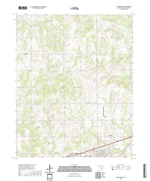
2022 Map of Stroud North
USGS Topo · Published 2022About this map
Euchee Cr and Turkey Cr carve through the rolling landscape of Lincoln County, defining a rural Oklahoma geography shaped by a network of sectional roads and small-scale watercourses. The northern outskirts of Stroud appear in the southern portion of the map, where the modern operations of the Stroud Municipal Airport and the Stroud Sewage Lagoon reflect contemporary infrastructure. Traces of older land use and family history are preserved at the Henry Cem and Black Cem, which sit alongside established routes like Oil Field Rd. The survey highlights a landscape where local history is etched into the names of creeks like Possum Trot Cr and Rattlesnake Cr, and in the alignment of historically significant thoroughfares such as Ozark Trail Rd. This topographic study documents the intersection of legacy rural property divisions and late-twentieth-century municipal expansion.
Find a feature on this map
71 named features on this map. Tap any name to fly to it.
Don’t see what you’re looking for? This feature index may not catch every label — zoom into the map to look around manually.
Map Details
Editions of this 2022 Stroud North Map
This is the sole edition of this map. No revisions or reprints were ever made.
Other maps of this area

1905 · Chandler
USGS Topo · 1:62,500

1907 · Chandler
USGS Topo · 1:62,500

1908 · Agra
USGS Topo · 1:62,500

1929 · Stroud
USGS Topo · 1:62,500

1931 · Drumright
USGS Topo · 1:62,500

1932 · Stroud
USGS Topo · 1:62,500

1954 · Oklahoma City
USGS Topo · 1:250,000

1957 · Oklahoma City
USGS Topo · 1:250,000

1963 · Oklahoma City
USGS Topo · 1:250,000
1974 · Davenport
USGS Topo · 1:24,000