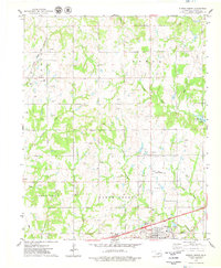
1975 Map of Stroud North
USGS Topo · Published 1979About this map
Oil and gas development defines the landscape north of Stroud in the mid-1970s, with countless derricks and rigs belonging to the North Fox Oil Field and surrounding petroleum zones. The terrain is a network of small drainages including Euchee Creek, Cunny Creek, and Salt Creek, which wind through the township boundaries of Ponca and North Keokuk.
Find a feature on this map
29 named features on this map. Tap any name to fly to it.
Don’t see what you’re looking for? This feature index may not catch every label — zoom into the map to look around manually.
Map Details
Editions of this 1975 Stroud North Map
This is the sole edition of this map. No revisions or reprints were ever made.
Other maps of this area

1905 · Chandler
USGS Topo · 1:62,500

1907 · Chandler
USGS Topo · 1:62,500

1908 · Agra
USGS Topo · 1:62,500

1929 · Stroud
USGS Topo · 1:62,500

1931 · Drumright
USGS Topo · 1:62,500

1932 · Stroud
USGS Topo · 1:62,500

1954 · Oklahoma City
USGS Topo · 1:250,000

1957 · Oklahoma City
USGS Topo · 1:250,000

1963 · Oklahoma City
USGS Topo · 1:250,000
1974 · Davenport
USGS Topo · 1:24,000