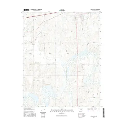
2016 Map of Stroud South
USGS Topo · Published 2016About this map
The southern portion of Stroud and the surrounding Lincoln County countryside are defined by the winding course of the Deep Fork river. This 2016 survey illustrates a landscape deeply rooted in its community history, evidenced by the high density of rural burial grounds scattered across the townships. From the Stroud Cem in the north to the Sac and Fox Tribal Cem and Rock Island Cem further south, these sites offer significant touchpoints for genealogical research. The terrain is crisscrossed by tributaries like Wild Horse Cr and Chuckaho Cr, while man-made landmarks such as Todd Lake and Clark Lake serve the local agricultural and water management needs of the region. The map also traces the rectilinear grid of county roads, including Oil Rd, which hints at the area's historical industrial ties.
Find a feature on this map
56 named features on this map. Tap any name to fly to it.
Don’t see what you’re looking for? This feature index may not catch every label — zoom into the map to look around manually.
Map Details
Editions of this 2016 Stroud South Map
This is the sole edition of this map. No revisions or reprints were ever made.
Other maps of this area

1905 · Chandler
USGS Topo · 1:62,500

1907 · Chandler
USGS Topo · 1:62,500

1908 · Agra
USGS Topo · 1:62,500

1929 · Stroud
USGS Topo · 1:62,500

1931 · Drumright
USGS Topo · 1:62,500

1932 · Stroud
USGS Topo · 1:62,500

1954 · Oklahoma City
USGS Topo · 1:250,000

1957 · Oklahoma City
USGS Topo · 1:250,000

1963 · Oklahoma City
USGS Topo · 1:250,000
1974 · Arlington
USGS Topo · 1:24,000