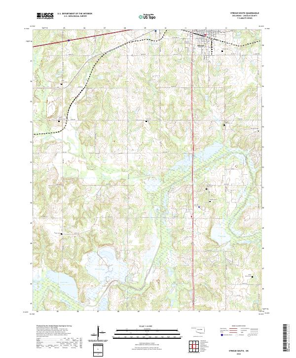
2022 Map of Stroud South
USGS Topo · Published 2022About this map
The southern portion of Stroud serves as the focal point for this Lincoln County survey, illustrating the intersection of established town planning and the surrounding agricultural landscape. Notable for its dense distribution of burial grounds, the area includes the Sac and Fox Tribal Cem, reflecting the deep tribal heritage of the region. The map tracks the winding course of the Deep Fork river, which meanders through a landscape of wetlands and varied topography alongside smaller tributaries like Wild Horse Cr and Dry Cr. Numerous family and community cemeteries such as Smith-Messer Cem, Arbor Grove Cem, and the isolated Rock Island Cem are preserved here, offering significant value for genealogists tracing early residents. The section-line road network, including routes like e0890 RD, defines the spatial organization of the rural countryside surrounding the town center.
Find a feature on this map
51 named features on this map. Tap any name to fly to it.
Don’t see what you’re looking for? This feature index may not catch every label — zoom into the map to look around manually.
Map Details
Editions of this 2022 Stroud South Map
This is the sole edition of this map. No revisions or reprints were ever made.
Other maps of this area

1905 · Chandler
USGS Topo · 1:62,500

1907 · Chandler
USGS Topo · 1:62,500

1908 · Agra
USGS Topo · 1:62,500

1929 · Stroud
USGS Topo · 1:62,500

1931 · Drumright
USGS Topo · 1:62,500

1932 · Stroud
USGS Topo · 1:62,500

1954 · Oklahoma City
USGS Topo · 1:250,000

1957 · Oklahoma City
USGS Topo · 1:250,000

1963 · Oklahoma City
USGS Topo · 1:250,000
1974 · Arlington
USGS Topo · 1:24,000