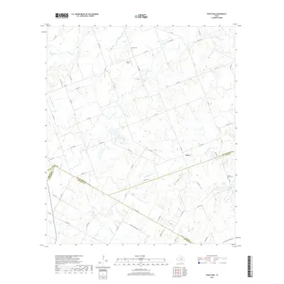
2019 Map of Structure
USGS Topo · Published 2019About this map
Siloam and Lawhon Springs anchor this rural landscape where the headwaters of several regional creek systems converge at the borders of Williamson, Lee, Bastrop, and Travis counties. The map captures a transition in the Central Texas terrain, defined by the winding paths of Middle Yegua Cr, Big Sandy Cr, and Brushy Cr. For genealogists and local historians, the sheet identifies specific burial sites including Mager Cem and Lawhon Springs Cem, alongside small-scale infrastructure like the Chan-C Airport. A dense network of county roads, such as Co RD 465 and Red Town Rd, reveals the enduring agricultural footprint and local property divisions of this multi-county borderland.
Find a feature on this map
66 named features on this map. Tap any name to fly to it.
Don’t see what you’re looking for? This feature index may not catch every label — zoom into the map to look around manually.
Map Details
Editions of this 2019 Structure Map
This is the sole edition of this map. No revisions or reprints were ever made.
Other maps of this area

1885 · Taylor
USGS Topo · 1:125,000

1885 · Bastrop
USGS Topo · 1:125,000

1887 · Taylor
USGS Topo · 1:125,000

1893 · Bastrop
USGS Topo · 1:125,000

1894 · Taylor
USGS Topo · 1:125,000

1904 · Bastrop
USGS Topo · 1:125,000

1948 · Elgin
USGS Topo · 1:62,500

1948 · Lexington
USGS Topo · 1:62,500

1950 · Lexington
USGS Topo · 1:62,500

1950 · Elgin
USGS Topo · 1:62,500