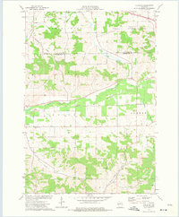
1973 Map of Strum SE
USGS Topo · Published 1975About this map
The Buffalo River corridor serves as the central artery for this portion of Trempealeau County, where the Chicago and North Western railroad follows the river valley through the township of Unity. This 1973 survey illustrates a landscape defined by its hydrology, with numerous named drainages such as Rumstead Valley, Johnson Valley Creek, and the North Branch Elk Creek carving through the terrain. Evidence of rural community life is visible in the placement of the West Beef River Cem and Prairie View Cem, alongside the small settlement of Holman in the southern portion of the quadrangle.
Find a feature on this map
26 named features on this map. Tap any name to fly to it.
Don’t see what you’re looking for? This feature index may not catch every label — zoom into the map to look around manually.
Map Details
Editions of this 1973 Strum SE Map
This is the sole edition of this map. No revisions or reprints were ever made.
Other maps of this area

1926 · Whitehall
USGS Topo · 1:62,500

1927 · Blair
USGS Topo · 1:62,500

1927 · Strum
USGS Topo · 1:62,500

1929 · Whitehall
USGS Topo · 1:62,500

1930 · Strum
USGS Topo · 1:62,500

1935 · Osseo
USGS Topo · 1:48,000

1940 · Osseo
USGS Topo · 1:62,500

1953 · Eau Claire
USGS Topo · 1:250,000

1958 · Eau Claire
USGS Topo · 1:250,000

1964 · Eau Claire
USGS Topo · 1:250,000