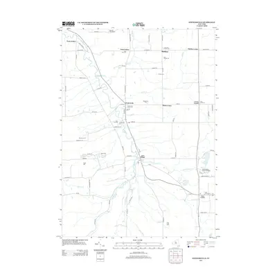
2013 Map of Strykersville
USGS Topo · Published 2013About this map
Strykersville and Java Village anchor this corner of Wyoming and Erie counties, where the winding course of Buffalo Creek and its tributaries have shaped the local landscape. The map highlights a series of small, well-established hamlets including Sheldon, Wales Hollow, and Java Center, each connected by a network of rural roads such as Dutch Hollow Road and Centerline Road. Several waterfalls are documented along these drainages, notably Johnson Falls on Sheldon Creek and Angel Falls near Java Village.
Find a feature on this map
81 named features on this map. Tap any name to fly to it.
Don’t see what you’re looking for? This feature index may not catch every label — zoom into the map to look around manually.
Map Details
Editions of this 2013 Strykersville Map
This is the sole edition of this map. No revisions or reprints were ever made.
Other maps of this area

1905 · Attica
USGS Topo · 1:62,500

1905 · Depew
USGS Topo · 1:62,500

1923 · Arcade
USGS Topo · 1:62,500

1925 · Springville
USGS Topo · 1:62,500

1925 · Arcade
USGS Topo · 1:62,500

1948 · Depew
USGS Topo · 1:62,500

1949 · Attica
USGS Topo · 1:62,500

1949 · Cowlesville
USGS Topo · 1:24,000
1949 · Attica
USGS Topo · 1:24,000
1950 · East Aurora
USGS Topo · 1:24,000