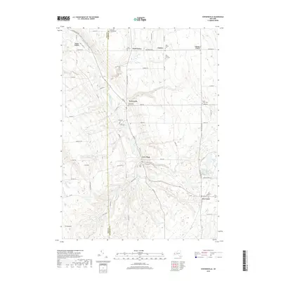
2019 Map of Strykersville
USGS Topo · Published 2019About this map
Buffalo Creek and its many tributaries, including Wales Creek and Beaver Meadow Cr, carve through the western New York countryside along the border of Erie Co and Wyoming Co. This 2019 survey documents a landscape defined by small crossroads settlements and a deep-rooted network of rural cemeteries. In Strykersville, the Strykersville Pioneer Cem and Saint Marys Cem suggest generations of local history, while the Bloecher Farm Airport to the north reflects modern local aviation needs.
Find a feature on this map
77 named features on this map. Tap any name to fly to it.
Don’t see what you’re looking for? This feature index may not catch every label — zoom into the map to look around manually.
Map Details
Editions of this 2019 Strykersville Map
This is the sole edition of this map. No revisions or reprints were ever made.
Other maps of this area

1905 · Attica
USGS Topo · 1:62,500

1905 · Depew
USGS Topo · 1:62,500

1923 · Arcade
USGS Topo · 1:62,500

1925 · Springville
USGS Topo · 1:62,500

1925 · Arcade
USGS Topo · 1:62,500

1948 · Depew
USGS Topo · 1:62,500

1949 · Attica
USGS Topo · 1:62,500

1949 · Cowlesville
USGS Topo · 1:24,000
1949 · Attica
USGS Topo · 1:24,000
1950 · East Aurora
USGS Topo · 1:24,000