
2010 Map of Stuart
USGS Topo · Published 2010About this map
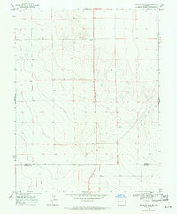
Stuart sits at the center of this high plains landscape, defined by the rigid geometry of the public land survey system. Located along the east-west corridor of County Hwy N, this small settlement is surrounded by a sprawling network of agricultural access roads including County Road M and County Road L. The terrain is characterized by its remarkable flatness, typical of the Kiowa County region, where the primary interruptions to the grid are natural depressions and small water bodies. To the north, the Budde Landing Strip reflects the importance of private aviation in managing these large territorial tracts. This map serves as a clear record of the intersection between modern aerial infrastructure and the traditional ranching and farming blocks that have shaped the Colorado plains for generations.
Find a feature on this map
13 named features on this map. Tap any name to fly to it.
Don’t see what you’re looking for? This feature index may not catch every label — zoom into the map to look around manually.
Map Details
Editions of this 2010 Stuart Map
This is the sole edition of this map. No revisions or reprints were ever made.
Other maps of this area

1890 · Granada
USGS Topo · 1:125,000

1892 · Cheyenne Wells
USGS Topo · 1:125,000

1892 · Granada
USGS Topo · 1:125,000

1894 · Cheyenne Wells
USGS Topo · 1:125,000

1894 · Granada
USGS Topo · 1:125,000

1954 · Lamar
USGS Topo · 1:250,000

1958 · Lamar
USGS Topo · 1:250,000

1968 · Stuart
USGS Topo · 1:24,000

1968 · Sheridan Lake
USGS Topo · 1:24,000
1968 · Sheridan Lake SE
USGS Topo · 1:24,000