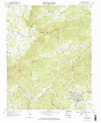
1967 Map of Stuart
USGS Topo · Published 1971About this map
The Dan River and South Mayo River headwaters define this portion of Patrick County in the late 1960s. The terrain is marked by significant elevation changes, notably at Lovers Leap and along the slopes of Bull Mountain. This era shows a landscape transitioning from rural isolation toward modern infrastructure, with a Sewage Disposal plant and Hospital established near the town of Stuart. The road network connects small crossroads like Vesta and Dobyns to larger landmarks such as the Stuart High School.
Find a feature on this map
46 named features on this map. Tap any name to fly to it.
Don’t see what you’re looking for? This feature index may not catch every label — zoom into the map to look around manually.
Map Details
Editions of this 1967 Stuart Map
2 editions found
Other maps of this area

1926 · Critz
USGS Topo · 1:48,000

1928 · Stuart
USGS Topo · 1:48,000

1928 · Critz
USGS Topo · 1:62,500

1931 · Stuart
USGS Topo · 1:62,500

1953 · Winston-Salem
USGS Topo · 1:250,000

1955 · Winston-Salem
USGS Topo · 1:250,000

1957 · Endicott
USGS Topo · 1:62,500

1957 · Floyd
USGS Topo · 1:62,500

1962 · Winston-Salem
USGS Topo · 1:250,000

1967 · Patrick Springs
USGS Topo · 1:24,000