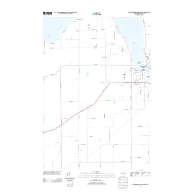
2013 Map of Sturgeon Bay West
USGS Topo · Published 2013About this map
The city of Sturgeon Bay serves as the focal point of this coastal survey, where the downtown area meets the waterfront at the Sturgeon Bay Bridge and the Sturgeon Yacht Harbor. The landscape transitions from the urban grid to the wooded expanse of Potawatomi State Park along the shoreline, characterized by prominent features like Hills Point and the underwater hazard of Dunlap Reef. Further inland, the transportation network is anchored by the Door County Cherryland Airport and the intersection of Wi-57 and Wi-42. Rural road names such as Roalkvam Rd, Eliason Rd, and Malvitz Rd hint at the local family history and agricultural roots of the peninsula. Small waterways including Larson Cr and Stony Cr drain toward the larger waters of Lake Michigan, while recreational areas like Lost Creek Golf Course and Bradley Lake offer a view into the region's modern land use and leisure culture.
Find a feature on this map
82 named features on this map. Tap any name to fly to it.
Don’t see what you’re looking for? This feature index may not catch every label — zoom into the map to look around manually.
Map Details
Editions of this 2013 Sturgeon Bay West Map
This is the sole edition of this map. No revisions or reprints were ever made.
Other maps of this area

1952 · Casco
USGS Topo · 1:62,500

1954 · Manitowoc
USGS Topo · 1:250,000

1958 · Manitowoc
USGS Topo · 1:250,000

1960 · Sturgeon Bay
USGS Topo · 1:62,500

1960 · Algoma
USGS Topo · 1:62,500

1961 · Little Sturgeon
USGS Topo · 1:62,500

1978 · Brussels
USGS Topo · 1:24,000

1981 · Sturgeon Bay West
USGS Topo · 1:24,000

1981 · Institute
USGS Topo · 1:24,000
1981 · Idlewild
USGS Topo · 1:24,000