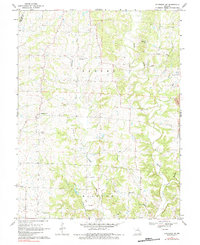
1969 Map of Sturgeon SW
USGS Topo · Published 1984About this map
Woodlandville and New Providence anchor this mid-Missouri landscape where the rolling hills of Boone County meet the borders of Howard and Moniteau. The area is defined by a dense network of watercourses, with Perche Creek and Callahan Creek draining the central terrain, while Silver Fork and Slacks Branch wind through the eastern reaches. The cultural geography is preserved through numerous rural institutions, including Bethlehem Ch, Red Rock Ch, and Hatton Chapel.
Find a feature on this map
23 named features on this map. Tap any name to fly to it.
Don’t see what you’re looking for? This feature index may not catch every label — zoom into the map to look around manually.
Map Details
Editions of this 1969 Sturgeon SW Map
2 editions found
Other maps of this area

1886 · Jefferson City
USGS Topo · 1:125,000

1888 · Boonville
USGS Topo · 1:125,000

1890 · Moberly
USGS Topo · 1:125,000

1890 · Glasgow
USGS Topo · 1:125,000

1894 · Jefferson City
USGS Topo · 1:125,000

1917 · Sturgeon
USGS Topo · 1:62,500

1935 · Columbia
USGS Topo · 1:24,000

1940 · Columbia
USGS Topo · 1:24,000

1947 · Jefferson City
USGS Topo · 1:250,000
1948 · Columbia
USGS Topo · 1:24,000