
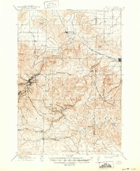
1915 Map of Sturgis
USGS Topo · Published 1915About this map
Gold mining operations and military outposts define this 1915 survey of the northern Black Hills. The bustling center of Deadwood sits at the convergence of narrow gulches, while nearby Lead and Galena anchor a landscape intensive with industrial activity. The map specifically identifies the Golden Crest Mine and Gilt Edge Maid Mine southeast of Lexington Hill, illustrating the scale of resource extraction during this era.
Find a feature on this map
76 named features on this map. Tap any name to fly to it.
Don’t see what you’re looking for? This feature index may not catch every label — zoom into the map to look around manually.
Map Details
Editions of this 1915 Sturgis Map
2 editions found
Other maps of this area

1893 · Rapid
USGS Topo · 1:125,000

1894 · Deadwood
USGS Topo · 1:125,000

1898 · Rapid
USGS Topo · 1:125,000

1899 · Sturgis
USGS Topo · 1:62,500

1900 · Spearfish
USGS Topo · 1:62,500

1901 · Deadwood
USGS Topo · 1:125,000

1903 · Rapid
USGS Topo · 1:125,000

1905 · Saint Onge
USGS Topo · 1:62,500

1906 · Vale
USGS Topo · 1:62,500

1907 · Belle Fourche
USGS Topo · 1:125,000