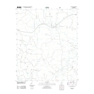
2012 Map of Sturgis
USGS Topo · Published 2012About this map
Sturgis serves as the primary hub of this landscape, situated at a junction of roads and rail lines where the Old Sturgis Cem and Sturgis Cem mark the community's long-standing presence. The surrounding Oktibbeha County terrain is defined by a dense network of creeks, including Sand Cr, Red Bank Cr, and Bogue Fallah, which drain toward the Noxubee River in the southwest.
Find a feature on this map
94 named features on this map. Tap any name to fly to it.
Don’t see what you’re looking for? This feature index may not catch every label — zoom into the map to look around manually.
Map Details
Editions of this 2012 Sturgis Map
This is the sole edition of this map. No revisions or reprints were ever made.
Other maps of this area

1953 · West Point
USGS Topo · 1:250,000

1958 · West Point
USGS Topo · 1:250,000

1963 · West Point
USGS Topo · 1:250,000

1965 · Longview
USGS Topo · 1:24,000

1965 · Bradley
USGS Topo · 1:24,000

1972 · Louisville North
USGS Topo · 1:24,000

1972 · Highpoint
USGS Topo · 1:24,000

1972 · Double Springs
USGS Topo · 1:24,000

1972 · Sturgis
USGS Topo · 1:24,000
1972 · Reform
USGS Topo · 1:24,000