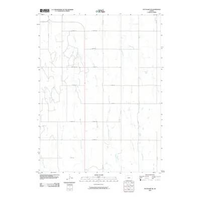
2009 Map of Stuttgart NE
USGS Topo · Published 2009About this map
Walnut Creek and several other northern tributaries of the Solomon River basin define this rural landscape in north-central Kansas. The terrain is organized by a strict section-line grid of local roads, such as W Buffalo Rd and E Hunter Rd, which underscore the agricultural purpose of the land in the early 21st century. The map shows how water drainage dictates the placement of roads and field boundaries, with West Big Creek and East Big Creek carving north-to-south paths through the prairie. While the area lacks dense settlements, the intricate network of secondary roads like E 100 Rd and W 200 Rd provides access to many farmsteads. This survey reveals the enduring rural character of Phillips County, where seasonal streams like Plotner Creek and Spring Creek remain the most significant landmarks on the open landscape.
Find a feature on this map
25 named features on this map. Tap any name to fly to it.
Don’t see what you’re looking for? This feature index may not catch every label — zoom into the map to look around manually.
Map Details
Editions of this 2009 Stuttgart NE Map
This is the sole edition of this map. No revisions or reprints were ever made.
Other maps of this area

1893 · Phillipsburg
USGS Topo · 1:125,000

1896 · Holdrege
USGS Topo · 1:125,000

1955 · Grand Island
USGS Topo · 1:250,000

1955 · Beloit
USGS Topo · 1:250,000

1957 · Grand Island
USGS Topo · 1:250,000

1958 · Grand Island
USGS Topo · 1:250,000

1959 · Beloit
USGS Topo · 1:250,000

1968 · Woodruff
USGS Topo · 1:24,000

1973 · Stuttgart NE
USGS Topo · 1:24,000
1973 · Kensington NW
USGS Topo · 1:24,000