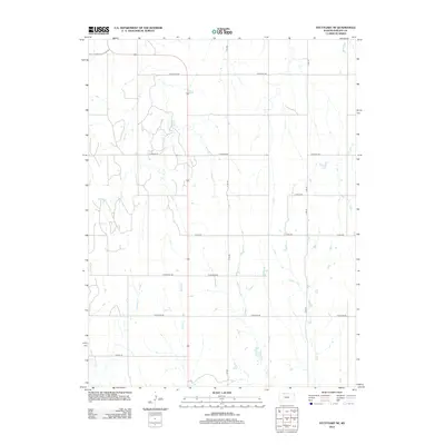
2012 Map of Stuttgart NE
USGS Topo · Published 2012About this map
The agrarian landscape of Phillips County is defined by a strictly organized section-line road network and a series of north-south drainage systems. Tributaries including Spring Cr, W Big Cr, and E Big Cr cut across the prairie, creating a repetitive pattern of low-lying creek bottoms and higher agricultural tablelands. The infrastructure is characterized by a series of long-distance rural routes such as W Buffalo Rd and W Iron Rd, which follow the township and range survey lines that have dictated Kansas land use for over a century.
Find a feature on this map
18 named features on this map. Tap any name to fly to it.
Don’t see what you’re looking for? This feature index may not catch every label — zoom into the map to look around manually.
Map Details
Editions of this 2012 Stuttgart NE Map
This is the sole edition of this map. No revisions or reprints were ever made.
Other maps of this area

1893 · Phillipsburg
USGS Topo · 1:125,000

1896 · Holdrege
USGS Topo · 1:125,000

1955 · Grand Island
USGS Topo · 1:250,000

1955 · Beloit
USGS Topo · 1:250,000

1957 · Grand Island
USGS Topo · 1:250,000

1958 · Grand Island
USGS Topo · 1:250,000

1959 · Beloit
USGS Topo · 1:250,000

1968 · Woodruff
USGS Topo · 1:24,000

1973 · Stuttgart NE
USGS Topo · 1:24,000
1973 · Kensington NW
USGS Topo · 1:24,000