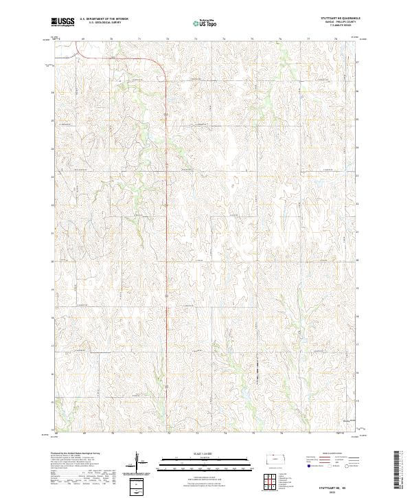
2022 Map of Stuttgart NE
USGS Topo · Published 2022About this map
Spring Cr and the branching drainages of the Big Creek system define the landscape of Phillips County in this recent topographical survey. The map depicts a strictly organized grid of rural section lines, where roads such as W Buffalo Rd, E Cherokee Rd, and W Iron Rd delineate the boundaries of agrarian parcels. This network of thoroughfares reveals the enduring influence of the Public Land Survey System, which remains the primary framework for land division in the region. The intermittent flow of W Big Cr and E Big Cr suggests a terrain shaped by seasonal water movement, further evidenced by the named lowlands of Brushy Draw in the southeastern corner. This area serves as a study in modern Great Plains rural geography, where local infrastructure is precisely tuned to the natural topography of the creek valleys.
Find a feature on this map
24 named features on this map. Tap any name to fly to it.
Don’t see what you’re looking for? This feature index may not catch every label — zoom into the map to look around manually.
Map Details
Editions of this 2022 Stuttgart NE Map
This is the sole edition of this map. No revisions or reprints were ever made.
Other maps of this area

1893 · Phillipsburg
USGS Topo · 1:125,000

1896 · Holdrege
USGS Topo · 1:125,000

1955 · Grand Island
USGS Topo · 1:250,000

1955 · Beloit
USGS Topo · 1:250,000

1957 · Grand Island
USGS Topo · 1:250,000

1958 · Grand Island
USGS Topo · 1:250,000

1959 · Beloit
USGS Topo · 1:250,000

1968 · Woodruff
USGS Topo · 1:24,000

1973 · Stuttgart NE
USGS Topo · 1:24,000
1973 · Kensington NW
USGS Topo · 1:24,000