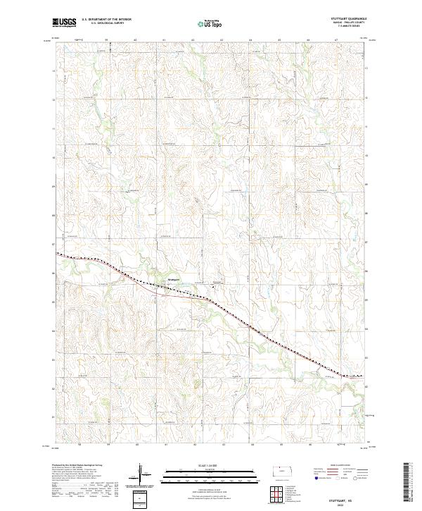
2022 Map of Stuttgart
USGS Topo · Published 2022About this map
The settlement of Stuttgart centers this agricultural landscape in Phillips County, serving as a quiet hub for the surrounding township sections. Life here revolves around the section-line road network and the seasonal flow of local waterways, including Deer Cr and Starvation Cr. A significant cultural anchor for the community is the Emmanuel Lutheran Cem, located just east of the village. The terrain is defined by the gentle drainage patterns of Boughton Cr and Bissell Cr, which carve subtle valleys through the high plains. This 2022 survey illustrates the enduring township and range system, where large-scale farming is meticulously organized by roads like W Ridge Rd and W Jade Rd, maintaining the rural character of this northern Kansas prairie.
Find a feature on this map
32 named features on this map. Tap any name to fly to it.
Don’t see what you’re looking for? This feature index may not catch every label — zoom into the map to look around manually.
Map Details
Editions of this 2022 Stuttgart Map
This is the sole edition of this map. No revisions or reprints were ever made.
Other maps of this area

1893 · Norton
USGS Topo · 1:125,000

1893 · Phillipsburg
USGS Topo · 1:125,000

1955 · Beloit
USGS Topo · 1:250,000

1959 · Beloit
USGS Topo · 1:250,000
1967 · Long Island
USGS Topo · 1:24,000

1968 · Woodruff
USGS Topo · 1:24,000

1972 · Speed
USGS Topo · 1:24,000

1972 · Phillipsburg South
USGS Topo · 1:24,000

1973 · Stuttgart NE
USGS Topo · 1:24,000
1973 · Phillipsburg North
USGS Topo · 1:24,000