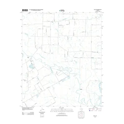
2012 Map of Styx
USGS Topo · Published 2012About this map
The Trinity River defines the winding southern boundary of this landscape, its meanders creating a complex network of oxbows and wetlands including Berry Lake and Round Pond. The area is characterized by small, scattered settlements like Styx and Aley, where agricultural life is punctuated by local landmarks like Blanton Rnch. For genealogists, the map preserves the locations of several burial sites, such as Ware Cem and Timothy Cem, which sit alongside historic crossings and landings such as Porters Bluff. Numerous creeks, including Caney Cr and Bois d'Arc Cr, feed into the Trinity, illustrating the drainage patterns that have shaped land use and property boundaries in this part of Henderson County.
Find a feature on this map
72 named features on this map. Tap any name to fly to it.
Don’t see what you’re looking for? This feature index may not catch every label — zoom into the map to look around manually.
Map Details
Editions of this 2012 Styx Map
This is the sole edition of this map. No revisions or reprints were ever made.
Other maps of this area

1920 · Kemp
USGS Topo · 1:62,500

1954 · Dallas
USGS Topo · 1:250,000

1957 · Kemp
USGS Topo · 1:62,500

1958 · Dallas
USGS Topo · 1:250,000

1960 · Tool
USGS Topo · 1:24,000

1960 · Grays Prairie
USGS Topo · 1:24,000

1961 · Kemp
USGS Topo · 1:24,000

1961 · Kerens
USGS Topo · 1:24,000

1961 · Chatfield
USGS Topo · 1:24,000

1962 · Bazette
USGS Topo · 1:24,000