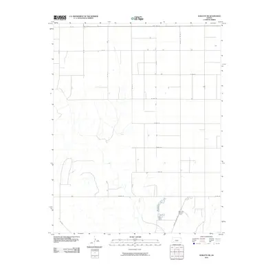
2010 Map of Sublette SW
USGS Topo · Published 2010About this map
The agricultural landscape of southwest Kansas is defined by a rigorous grid of section lines and gravel roads on this 2010 survey. Traveling through this portion of Seward County, State Hwy 190 runs along the northern boundary, while a network of rural routes like 22 Rd and Co Rd G provide access to the vast plains. A notable local landmark is the Supreme Feeders Airport, situated near the junction of Satanta Cut Off Rd and 17 Mile Rd. This area illustrates the large-scale cattle feeding and farming operations typical of the High Plains, where aviation serves as a practical tool for industrial agriculture. Drainage patterns are sparse, characterized by intermittent streams that wind through the southern sections toward Moscow Rd.
Find a feature on this map
18 named features on this map. Tap any name to fly to it.
Don’t see what you’re looking for? This feature index may not catch every label — zoom into the map to look around manually.
Map Details
Editions of this 2010 Sublette SW Map
This is the sole edition of this map. No revisions or reprints were ever made.
Other maps of this area

1944 · Moscow
USGS Topo · 1:62,500

1945 · Moscow
USGS Topo · 1:62,500

1955 · Dodge City
USGS Topo · 1:250,000

1958 · Dodge City
USGS Topo · 1:250,000

1959 · Dodge City
USGS Topo · 1:250,000

1968 · Sublette SW
USGS Topo · 1:24,000
1968 · Satanta
USGS Topo · 1:24,000

1968 · Liberal NE
USGS Topo · 1:24,000

1968 · Sublette SE
USGS Topo · 1:24,000

1968 · Liberal NW
USGS Topo · 1:24,000