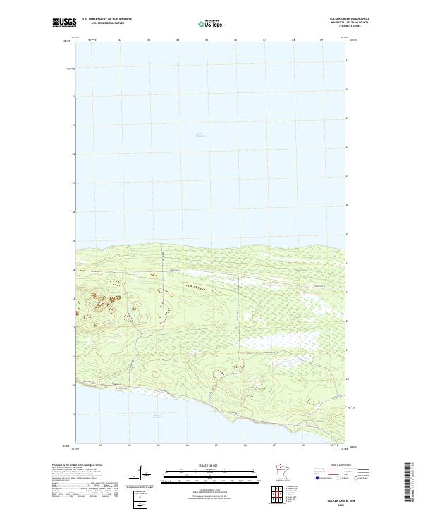
2022 Map of Sucker Creek
USGS Topo · Published 2022About this map
Upper Red Lake and Lower Red Lake dominate this landscape in northern Minnesota, separated by a narrow land bridge that defines the character of the region. The map illustrates a network of reservation roads, including Resvn Hwy 18 and N Ponemah Rd, which skirt the southern shores and provide access to the interior. The terrain between the lakes is characterized by extensive wetlands and drainage patterns, most notably Sucker Cr, which meanders through the eastern section of the quadrangle. This 2022 survey detail shows the specific alignment of local infrastructure like Sucker Creek Rd and Old Camp Rd against the natural lake margins. The land remains largely undeveloped, preserving the original surveying boundaries of T153N and T152N within Beltrami County.
Find a feature on this map
19 named features on this map. Tap any name to fly to it.
Don’t see what you’re looking for? This feature index may not catch every label — zoom into the map to look around manually.
Map Details
Editions of this 2022 Sucker Creek Map
This is the sole edition of this map. No revisions or reprints were ever made.
Other maps of this area

1919 · Fox
USGS Topo · 1:62,500

1919 · Quiring
USGS Topo · 1:62,500

1919 · Ponemah
USGS Topo · 1:62,500

1943 · Ponemah
USGS Topo · 1:62,500

1954 · Bemidji
USGS Topo · 1:250,000

1954 · Roseau
USGS Topo · 1:250,000

1957 · Roseau
USGS Topo · 1:250,000

1957 · Bemidji
USGS Topo · 1:250,000

1958 · Bemidji
USGS Topo · 1:250,000

1958 · Roseau
USGS Topo · 1:250,000