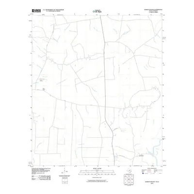
2010 Map of Sudduth Bluff
USGS Topo · Published 2010About this map
Little Cypress Creek and Nichols Creek dominate this low-lying landscape along the Texas-Louisiana border just before the turn of the decade. The map captures a transitional rural environment where drainage features like Pocket Slough and Cole Slough define the terrain leading toward the Sabine River. Local genealogy and settlement patterns are anchored by family-named landmarks, including the Wright Cemetery accessed via Wright Cem Rd and the Laurel Sudduth Bluff Cemetery near the riverbank.
Find a feature on this map
24 named features on this map. Tap any name to fly to it.
Don’t see what you’re looking for? This feature index may not catch every label — zoom into the map to look around manually.
Map Details
Editions of this 2010 Sudduth Bluff Map
This is the sole edition of this map. No revisions or reprints were ever made.
Other maps of this area

1947 · Starks
USGS Topo · 1:31,680

1947 · Carter Creek
USGS Topo · 1:31,680

1949 · Bancroft
USGS Topo · 1:31,680

1952 · Lake Charles
USGS Topo · 1:250,000

1954 · Lake Charles
USGS Topo · 1:250,000

1955 · Bessmay
USGS Topo · 1:62,500

1958 · Kirbyville
USGS Topo · 1:62,500
1959 · Starks
USGS Topo · 1:62,500
1959 · Bon Wier
USGS Topo · 1:62,500
1982 · Starks
USGS Topo · 1:24,000