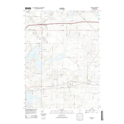
2013 Map of Suffield
USGS Topo · Published 2013About this map
Mogadore Reservoir and Wingfoot Lake dominate the hydrography of this Portage County landscape, reflecting the significant water management and recreation infrastructure of the early 21st century. The area around Brimfield shows a dense network of residential development, with newer streets like Arcadia Rd and Dussel Rd branching off established thoroughfares. The map preserves the locations of numerous historic burial grounds that serve as essential markers for local family history, including the Upson Meacham Cem and Thorndyke Cem.
Find a feature on this map
112 named features on this map. Tap any name to fly to it.
Don’t see what you’re looking for? This feature index may not catch every label — zoom into the map to look around manually.
Map Details
Editions of this 2013 Suffield Map
This is the sole edition of this map. No revisions or reprints were ever made.
Other maps of this area

1901 · Canton
USGS Topo · 1:62,500

1903 · Canton
USGS Topo · 1:62,500

1906 · Kent
USGS Topo · 1:62,500

1906 · Ravenna
USGS Topo · 1:62,500

1908 · Ravenna
USGS Topo · 1:62,500

1909 · Alliance
USGS Topo · 1:62,500

1950 · Cleveland
USGS Topo · 1:250,000

1951 · Canton
USGS Topo · 1:250,000

1953 · Canton
USGS Topo · 1:250,000
1953 · Hudson
USGS Topo · 1:24,000