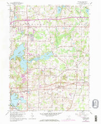
1960 Map of Suffield
USGS Topo · Published 1971About this map
The waters of the Mogadore Reservoir and the adjacent Wingfoot Lake dominate this portion of the Connecticut Western Reserve, illustrating the transition from agricultural land to managed water resources in the mid-20th century. Established townships including Brimfield, Rootstown, Suffield, and Randolph are well-defined, showing a landscape dotted with family-named landmarks like the Upson Meacham Cem and local spiritual centers such as St Joseph Ch. A unique industrial feature of the area is the Blimp Landing Field near the southwestern shore of Wingfoot Lake, reflecting the region's historical ties to aerospace manufacturing. Transport networks are anchored by the Norfolk and Western railroad, which served local stops at Brimfield Station and Suffield Station, connecting these rural communities to the industrial hubs of Northeast Ohio. Numerous sand and gravel pits are scattered throughout the quadrangle, indicating the local reliance on glacial deposits for industry.
Find a feature on this map
47 named features on this map. Tap any name to fly to it.
Don’t see what you’re looking for? This feature index may not catch every label — zoom into the map to look around manually.
Map Details
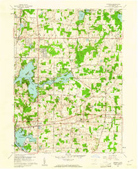
Editions of this 1960 Suffield Map
2 editions found
Other maps of this area

1901 · Canton
USGS Topo · 1:62,500

1903 · Canton
USGS Topo · 1:62,500

1906 · Kent
USGS Topo · 1:62,500

1906 · Ravenna
USGS Topo · 1:62,500

1908 · Ravenna
USGS Topo · 1:62,500

1909 · Alliance
USGS Topo · 1:62,500

1950 · Cleveland
USGS Topo · 1:250,000

1951 · Canton
USGS Topo · 1:250,000

1953 · Canton
USGS Topo · 1:250,000
1953 · Hudson
USGS Topo · 1:24,000