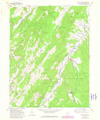
1969 Map of Sugar Grove
USGS Topo · Published 1982About this map
The Sugar Grove U S Naval Radio Station occupies a significant portion of the landscape along the Little Potomac River, a unique installation amidst the agrarian and forested terrain of Pendleton County. This 1969 survey, photorevised in the early 1980s, captures a network of small mountain communities including Sugar Grove, Dahmer, and Moyers. The rugged topography is defined by prominent features such as Sharp Ridge, Sugar Grove Mountain, and Hoover Mountain, which hem in the narrow valleys where local life centered around rural landmarks like St Lukes Ch and Thorn Ch. The map details the transition between settled valley floors and the protected timberlands of the George Washington National Forest. Evidence of long-standing family land use is found in labels like Propstburg and Propst Gap, while numerous cemeteries scattered across the slopes offer valuable data for genealogical research in this Appalachian corridor.
Find a feature on this map
59 named features on this map. Tap any name to fly to it.
Don’t see what you’re looking for? This feature index may not catch every label — zoom into the map to look around manually.
Map Details
Editions of this 1969 Sugar Grove Map
3 editions found
Other maps of this area

1892 · Franklin
USGS Topo · 1:125,000

1894 · Staunton
USGS Topo · 1:125,000

1896 · Franklin
USGS Topo · 1:125,000

1922 · Fort Seybert
USGS Topo · 1:48,000

1922 · Circleville
USGS Topo · 1:62,500

1924 · Circleville
USGS Topo · 1:48,000

1924 · Mc Dowell
USGS Topo · 1:62,500

1924 · Fort Seybert
USGS Topo · 1:62,500

1944 · Parnassus
USGS Topo · 1:62,500

1944 · Mc Dowell
USGS Topo · 1:62,500