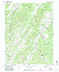
1969 Map of Sugar Grove
USGS Topo · Published 1983About this map
The South Branch Potomac River winds through the heart of this Pendleton County landscape, where the ridges of Dickinson Ridge and Sharp Mountain Ridge dictate the pattern of human settlement. In the late 1960s, small agricultural communities like Sugar Grove, Propstburg, and Dahmer remained connected by winding mountain roads and country churches, including Calvary Ch and St Lukes Ch. A significant military presence is documented at the Sugar Grove US Naval Radio Station, which occupies a specialized site within the valley. The map reveals the deep integration of public land, as much of the southern territory falls within the George Washington National Forest. Local families and genealogists will find numerous small cemeteries and landmarks like Thorn Spring Park and Socrates Mtn that help define the historical geography of these remote Appalachian hollows.
Find a feature on this map
58 named features on this map. Tap any name to fly to it.
Don’t see what you’re looking for? This feature index may not catch every label — zoom into the map to look around manually.
Map Details
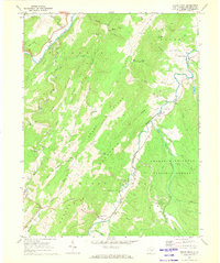
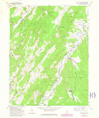
Editions of this 1969 Sugar Grove Map
3 editions found
Other maps of this area

1892 · Franklin
USGS Topo · 1:125,000

1894 · Staunton
USGS Topo · 1:125,000

1896 · Franklin
USGS Topo · 1:125,000

1922 · Fort Seybert
USGS Topo · 1:48,000

1922 · Circleville
USGS Topo · 1:62,500

1924 · Circleville
USGS Topo · 1:48,000

1924 · Mc Dowell
USGS Topo · 1:62,500

1924 · Fort Seybert
USGS Topo · 1:62,500

1944 · Parnassus
USGS Topo · 1:62,500

1944 · Mc Dowell
USGS Topo · 1:62,500