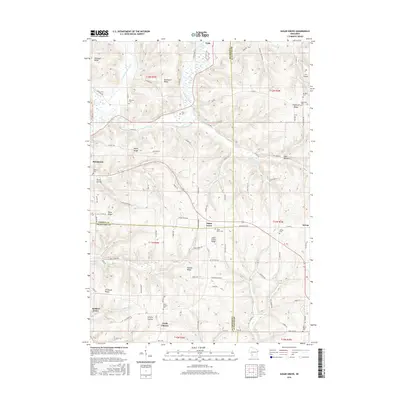
2016 Map of Sugar Grove
USGS Topo · Published 2016About this map
Sugar Grove and the surrounding Driftless Area of Wisconsin are defined by a complex network of high ridges and deep hollows, where the Kickapoo River and its W Fork Kickapoo River carve through the landscape. This 2016 survey shows a rural geography where community life is centered on scattered settlements like Viola, North Clayton, and Sylvan. The terrain is marked by prominent high points such as Pleasant Ridge, Buchanan Ridge, and Hustler Ridge, with winding roads like Sugar Grove Rd and Co Hwy U following the natural contours of the land. For genealogists, the map is particularly detailed in its placement of family and community burial grounds, including Manning Cem, Berry Cem, and Saint Peters Cem. From the small J & B Airport in the northeast to the northern edge of Soldiers Grove, the map documents a resilient rural structure where topography dictates the path of every stream and thoroughfare.
Find a feature on this map
105 named features on this map. Tap any name to fly to it.
Don’t see what you’re looking for? This feature index may not catch every label — zoom into the map to look around manually.
Map Details
Editions of this 2016 Sugar Grove Map
This is the sole edition of this map. No revisions or reprints were ever made.
Other maps of this area

1923 · Viroqua
USGS Topo · 1:62,500

1924 · Gays Mills
USGS Topo · 1:62,500

1926 · Gays Mills
USGS Topo · 1:62,500

1926 · Viroqua
USGS Topo · 1:62,500

1926 · La Farge
USGS Topo · 1:62,500

1933 · Boaz
USGS Topo · 1:62,500

1958 · La Crosse
USGS Topo · 1:250,000

1961 · La Crosse
USGS Topo · 1:250,000

1965 · La Crosse
USGS Topo · 1:250,000

1965 · La Farge
USGS Topo · 1:62,500