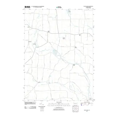
2010 Map of Sugar Lake
USGS Topo · Published 2010About this map
Sugar Lake sits at the heart of this Crawford County landscape, where the waters of Lake Creek and its many tributaries define the local geography. The map reveals a post-glacial environment marked by the Dead-Ice Terminal Moraine, a geological feature that has shaped the drainage patterns and placement of wetlands like those at Erie NWR Pool Number Seven and Erie NWR Pool Number Nine.
Find a feature on this map
76 named features on this map. Tap any name to fly to it.
Don’t see what you’re looking for? This feature index may not catch every label — zoom into the map to look around manually.
Map Details
Editions of this 2010 Sugar Lake Map
This is the sole edition of this map. No revisions or reprints were ever made.
Other maps of this area

1909 · Franklin
USGS Topo · 1:62,500

1911 · Franklin
USGS Topo · 1:62,500

1911 · Stoneboro
USGS Topo · 1:62,500

1913 · Stoneboro
USGS Topo · 1:62,500

1923 · Meadville
USGS Topo · 1:62,500

1925 · Meadville
USGS Topo · 1:62,500

1927 · Townville
USGS Topo · 1:48,000

1932 · Townville
USGS Topo · 1:62,500

1943 · Meadville
USGS Topo · 1:62,500

1943 · Stoneboro
USGS Topo · 1:62,500