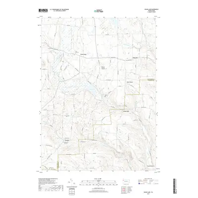
2019 Map of Sugar Lake
USGS Topo · Published 2019About this map
Sugar Lake serves as a central landmark in this portion of Crawford County, where the glacial history of the region is literally written into the landscape at the Dead-Ice Terminal Moraine. This geological feature dictates the local topography and drainage patterns for several waterways, including Lake Creek and Brawley Run. The area is characterized by a network of small, established communities such as Mount Hope and Black Ash, connected by rural routes like Guys Mill Rd.
Find a feature on this map
82 named features on this map. Tap any name to fly to it.
Don’t see what you’re looking for? This feature index may not catch every label — zoom into the map to look around manually.
Map Details
Editions of this 2019 Sugar Lake Map
This is the sole edition of this map. No revisions or reprints were ever made.
Other maps of this area

1909 · Franklin
USGS Topo · 1:62,500

1911 · Franklin
USGS Topo · 1:62,500

1911 · Stoneboro
USGS Topo · 1:62,500

1913 · Stoneboro
USGS Topo · 1:62,500

1923 · Meadville
USGS Topo · 1:62,500

1925 · Meadville
USGS Topo · 1:62,500

1927 · Townville
USGS Topo · 1:48,000

1932 · Townville
USGS Topo · 1:62,500

1943 · Meadville
USGS Topo · 1:62,500

1943 · Stoneboro
USGS Topo · 1:62,500