
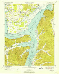
1936 Map of Sugar Tree
USGS Topo · Published 1936About this map
Sugar Tree and the rural communities along the Benton Co Decatur Co line appear here during a period of significant regional transition under the Tennessee Valley Authority. The map reveals a landscape defined by small-scale commerce and community centers, where landmarks like Malins Store, Spences Store, and Cozette served as the primary nodes of local life. The drainage network, featuring Sugar Creek, Lick Creek, and Wolf Creek, funnels toward the Tennessee River at the southeastern corner, illustrating the topography before later hydroelectric developments fully altered the river valley's character.
Find a feature on this map
49 named features on this map. Tap any name to fly to it.
Don’t see what you’re looking for? This feature index may not catch every label — zoom into the map to look around manually.
Map Details
Editions of this 1936 Sugar Tree Map
This is the sole edition of this map. No revisions or reprints were ever made.
Other maps of this area

1936 · Pine View
USGS Topo · 1:24,000

1936 · Parsons
USGS Topo · 1:24,000

1936 · Seventeen Creek
USGS Topo · 1:24,000

1936 · Daniels Landing
USGS Topo · 1:24,000

1936 · Jeannette
USGS Topo · 1:24,000

1936 · Cavvia
USGS Topo · 1:24,000

1936 · Rockport
USGS Topo · 1:24,000

1936 · Hustburg
USGS Topo · 1:24,000

1949 · Daniels Landing
USGS Topo · 1:24,000
1949 · Hustburg
USGS Topo · 1:24,000