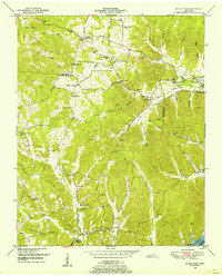
1949 Map of Sugar Tree
USGS Topo · Published 1953About this map
Benton and Decatur Counties meet along a ridge-heavy landscape in this 1949 survey, which captures the rural character of Tennessee before significant modern development. The northeastern corner is bounded by the Tennessee National Migratory Wildlife Refuge and the Kentucky Lake section of the Tennessee River, including Denson Island. The interior is defined by a network of ridges like Bumble Bee Ridge and Conrad Ridge, where small communities and family landmarks are concentrated.
Find a feature on this map
55 named features on this map. Tap any name to fly to it.
Don’t see what you’re looking for? This feature index may not catch every label — zoom into the map to look around manually.
Map Details
Editions of this 1949 Sugar Tree Map
2 editions found
Other maps of this area

1936 · Pine View
USGS Topo · 1:24,000

1936 · Parsons
USGS Topo · 1:24,000

1936 · Seventeen Creek
USGS Topo · 1:24,000

1936 · Daniels Landing
USGS Topo · 1:24,000

1936 · Jeannette
USGS Topo · 1:24,000

1936 · Sugar Tree
USGS Topo · 1:24,000

1936 · Cavvia
USGS Topo · 1:24,000

1936 · Rockport
USGS Topo · 1:24,000

1936 · Hustburg
USGS Topo · 1:24,000

1949 · Daniels Landing
USGS Topo · 1:24,000