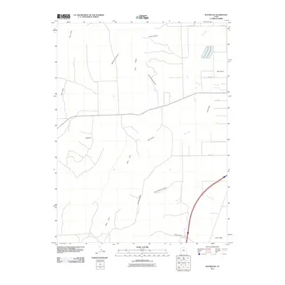
2011 Map of Sugarloaf
USGS Topo · Published 2011About this map
Juab Valley serves as a central corridor for this part of Utah, where the transition from flat valley floors to the surrounding high ground is marked by numerous canyons and ridges. The prominent peak of Sugarloaf stands as a landmark over a landscape defined by the drainage patterns of West Creek and Fourmile Creek. To the east, the terrain rises into Long Ridge and Levan Ridge, while the western portion of the map is dominated by the West Hills.
Find a feature on this map
21 named features on this map. Tap any name to fly to it.
Don’t see what you’re looking for? This feature index may not catch every label — zoom into the map to look around manually.
Map Details
Editions of this 2011 Sugarloaf Map
This is the sole edition of this map. No revisions or reprints were ever made.
Other maps of this area

1885 · Manti
USGS Topo · 1:250,000

1885 · Sevier Desert
USGS Topo · 1:250,000

1895 · Manti
USGS Topo · 1:250,000

1951 · Santaquin
USGS Topo · 1:62,500

1951 · Nephi
USGS Topo · 1:62,500

1953 · Delta
USGS Topo · 1:250,000

1954 · Tintic Mountain
USGS Topo · 1:24,000

1956 · Price
USGS Topo · 1:250,000

1958 · Delta
USGS Topo · 1:250,000

1960 · Price
USGS Topo · 1:250,000