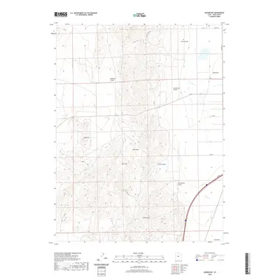
2020 Map of Sugarloaf
USGS Topo · Published 2020About this map
The West Hills and the prominent summit of Sugarloaf dominate this Juab County landscape, where deep drainage systems like Wide Canyon and Hall Canyon carve through the high ground. The terrain transitions from these high western ridges down toward the open floor of Juab Valley to the east. Water sources appear throughout the canyons as isolated points, notably Government Spring and Ornie Spring, which historically supported livestock and travelers in this arid environment. The map shows a network of named trails and tracks, such as Pace Spring Rd and Sheep Ln, that thread through the complex topography of Cazier Canyon and South Spring Canyon. This modern topographic study clarifies the connection between the rugged uplands and the drainage patterns that feed into Fourmile Cr and W Cr on the valley floor.
Find a feature on this map
24 named features on this map. Tap any name to fly to it.
Don’t see what you’re looking for? This feature index may not catch every label — zoom into the map to look around manually.
Map Details
Editions of this 2020 Sugarloaf Map
This is the sole edition of this map. No revisions or reprints were ever made.
Other maps of this area

1885 · Manti
USGS Topo · 1:250,000

1885 · Sevier Desert
USGS Topo · 1:250,000

1895 · Manti
USGS Topo · 1:250,000

1951 · Santaquin
USGS Topo · 1:62,500

1951 · Nephi
USGS Topo · 1:62,500

1953 · Delta
USGS Topo · 1:250,000

1954 · Tintic Mountain
USGS Topo · 1:24,000

1956 · Price
USGS Topo · 1:250,000

1958 · Delta
USGS Topo · 1:250,000

1960 · Price
USGS Topo · 1:250,000